Express News Service @ Belagavi: Karnataka, the seventh-largest State of the country, with a geographical area of 1,91,791 sq km accounts for 5. 83% of the geographical area of the country. What the good news is that according to the ‘Indian States of Forest Report, 2019’ the forest cover in this state has increased by 1025.48 Square Kilometers as compared to the assessment reported in ISFR 2017.
According to the 2019 report, the Very dense forest is spread over 4501 square kilometers, the Moderately dense forest(MDF) is spread over 21,048 square kilometers and the Open forest (OF) is spread over 13,026.24 square kilometers in Karnataka. The total forest cover counts 38,575.48 square kilometers in Karnataka.
Based on the interpretation of IRS Resources at-2 LISS III satellite data of the period November 2017 to March 2018, the forest cover in the state is 38,575.48 sq km which is 20.11% of the State’s geographical area.
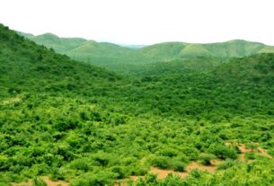
The State is endowed with a diverse climate, topography, and soils which have resulted in rich biodiversity.
The diverse ecological niches support characteristic flora and fauna. The evergreen forests of the
The Western Ghats, which cover about 60% of the forest area of State, is recognized as one of the 35 Biodiversity
Hotspots in the World and one of the four Biodiversity Hotspots of India.
As per the Champion & Seth classification of the Forest Types (1968), the forests in Karnataka belong to eight Forest Type Groups, which are further divided into 21 Forest Types. Protection and management of degraded forests through community participation is a major thrust area of the State Forest Department besides bio-diversity conservation and eco-tourism.